3D Scanning for Reality Capture
3D Scanning is the process for digitally capturing the precise shape, size and texture of real-world objects or physical environments. For example, when you need to digitize assets for enhanced engineering and design workflows or achieve a digital twin of your facility for compliance and safety, 3D Scanning will precisely create what is known as a point cloud, or a set of data points, by measuring many points on the external surface of an existing object. This process is also known as reality capture.
At Cirrus Design, we provide professional 3D scanning services using leading technologies and scanners from industry leaders like Matterport and Faro. We can take precise measurements from the field that can be viewed from the comfort of your office. We use AutoCAD, Autodesk Recap, Inventor and Solidworks, and our accurate scanned measurements can be turned into detailed shop drawings.
At Cirrus Design, we provide professional 3D scanning services using leading technologies and scanners from industry leaders like Matterport and Faro. We can take precise measurements from the field that can be viewed from the comfort of your office. We use AutoCAD, Autodesk Recap, Inventor and Solidworks, and our accurate scanned measurements can be turned into detailed shop drawings.
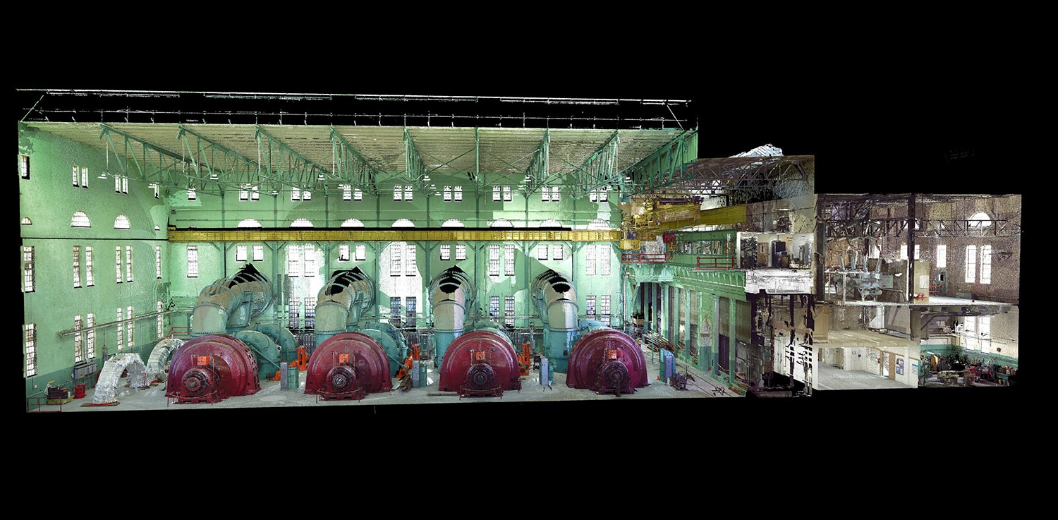
Industrial Plants
Our 3D scanning technology offers a powerful and effective means to accurately map existing facilities and industrial projects, helping our clients avoid problems and find solutions ahead of future construction phases.
LEARN MOREArch Eng Const (AEC)
We help our clients reduce file space consumption and offer optimized design services, with fast scan times that create detailed 3D point cloud information.
LEARN MOREReal Estate
Three-dimensional scanning technology has revolutionized the real estate industry. Today’s high-tech 3D scanners are capable of producing digital scans of virtually any building.
LEARN MOREReverse Engineering
Cirrus Design can help your company reverse engineer a product, and successfully convert a point cloud into a 3D model.
LEARN MOREPhotogrammetry
Our Licensed and professional pilots use drones with Survey Grade Real-Time Kinematic (RTK) technology. We take high resolution photos and stitch them together to create accurate and beautiful 3D Models, meshes and point clouds of your asset. Using Ground Control Points, we can also accurately map your asset to known Geolocations.
LEARN MORE