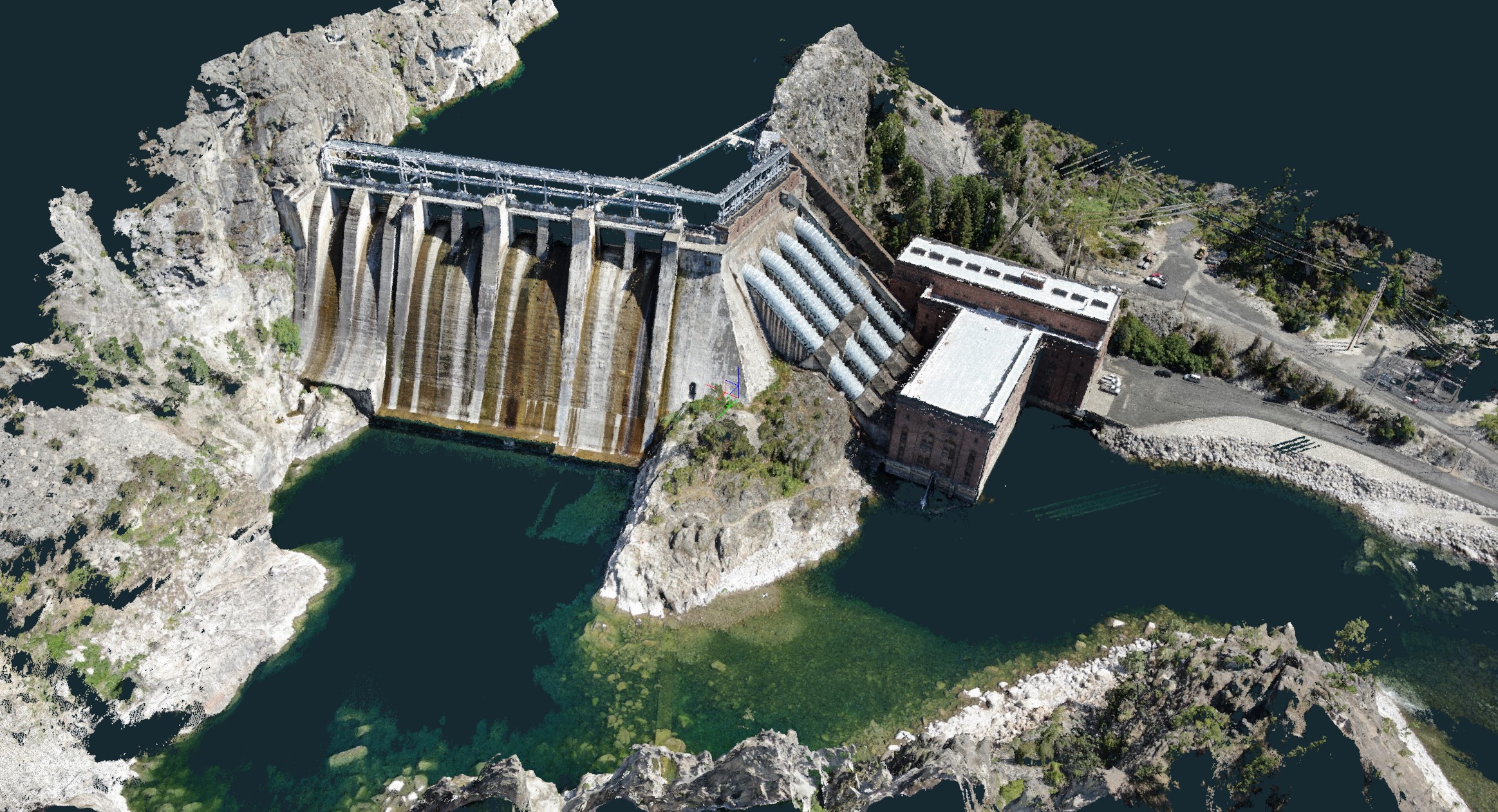
Photogrammetry
Our Licensed and professional pilots use drones with Survey Grade RTK. We take high resolution photos and stitch them together to create accurate and beautiful 3D Models, meshes and point clouds of your asset. Using Ground Control Points we can also accurately map your asset to known Geolocations.